Showing posts with label field trip. Show all posts

Friday, October 31, 2025

A Visit to Dark Swamp

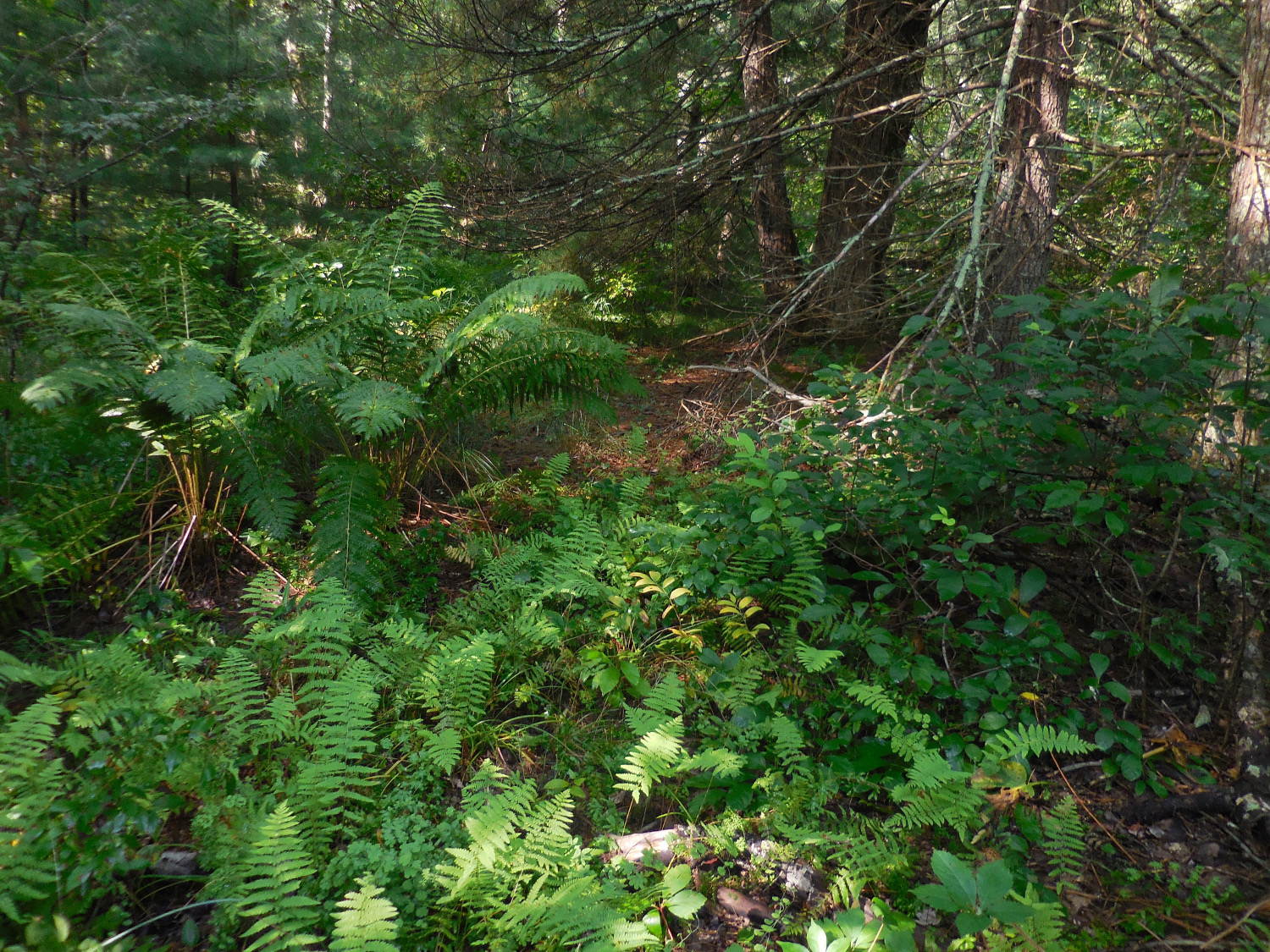
The edge of Dark Swamp.

 Out east on the Putnam Pike in Glocester, Rhode Island, on the border with Connecticut, there is a neglected patch of wild land with an eerie reputation: Dark Swamp. In November 1923, H.P. Lovecraft and fellow horror writer Clifford Martin Eddy Jr. attempted to travel to the swamp to investigate local legends of supernatural occurrences and nameless creatures. Although the authors never managed to find their way into the swamp itself, the lore and the atmosphere of the area may have helped inspire stories like The Dunwich Horror and The Colour Out of Space, and Lovecraft's letter about his trip to the vicinity of Dark Swamp is the main conduit through which knowledge of the legends of the swamp has survived to the present.   

Dark Swamp is located near the western edge of Glocester, RI, between Reynolds Rd and Willie Woodhead Rd, on state forest land associated with the Durfee Hill Management Area. I visited in December last year, starting on foot from the small parking area at the end of the paved northern section of Willie Woodhead Rd, and seeing the sights of the swamp from the maze of footpaths and wood roads west of W.W. Rd, with some bushwacking into interesting-looking locales. Logging and hunting takes place in the state forest, and a sign suggested that wearing blaze-orange is required for entry during hunting season. 

The inexplicably named, semi-impassible unpaved middle section of Willie Woodhead Rd, east of Dark Swamp. 

 The rough, hilly landscape in and around Dark Swamp is pretty typical of southeastern New England. The bedrock is the hard, pale granite of Avalonia, an ancient island arc pasted onto parts of coastal North America during the formation of Pangea. The soil is thin and acidic and mostly made of rocks. The uplands support a stunted, scraggly forest of White Pine, Pitch Pine and a half a dozen different oak species, with an understory of various blueberries, huckleberries and shadbushes, with mountain laurel and impenetrable tangles of catbrier here and there. This vegetation type is known as Oak-Heath Forest, and is found on poor, well-drained soils in the eastern US, mostly not too far from the sea. Low-lying areas are dominated by Eastern Hemlock and Red Maple, with an understory of highbush blueberries and Sweet Pepperbush. Lovecraft found the landscape of the rural Glocester hills, woods and isolated farmsteads to be uncommonly beautiful, and it still is lovely, but good lord imagine trying to make a living from agriculture on soil like that, in an era before powered equipment and chemical fertilizers.     

Grave of the infant Eliza Ann Bowen.

Cellar hole just east of Dark Swamp.
 Dark Swamp was not quite as shunned by humanity as Lovecraft suggests, and there are remains of 19th Century inhabitation on the eastern margins of the swamp. A small but still regularly maintained cemetery has graves from the Bowen family from the mid eighteen-hundreds. A little further south there is an early fieldstone cellar hole from a farmhouse, including the base of a massive central chimney, with surrounding stone walls and the remains of outbuildings. The buildings were electrified at some point in the 20th Century, and probably would have been standing and occupied in the 1920s for Lovecraft's visit, if he had managed to reach the area. 

A deep dug well next to the farmhouse ruins.

Flash photo down the well. 

Next to the cellar hole there is a deep dug well, lined with stone and with a pool of clear water at the bottom, maybe 20 feet down. It was strongly reminiscent of my image of the contaminated well in Colour Out of Space, but of course every lonely farmhouse in New England in the 18th, 19th and early 20th centuries would have had something similar. This particular example was quite well-preserved and deep; they are often shallow and collapsed or choked with debris when you run across them in the woods. 

Large cairn near Dark Swamp. 

Group of big cairns in a hollow between low ridges. 


One of the peculiar features of the Dark Swamp area is the unusual prevalence of cairns, or lithic sites. There was a striking group of about 20 large cairns, some almost as tall as me and 12-15 feet across, deeper in the forest in the vicinity of the farmhouse ruins, scattered around the floor and sides of a small hollow. These sorts of things could be prehistoric ceremonial grounds from Native Americans, or the product of the land-clearing efforts of settlers, or something else, but the large number and size of dry fieldstone structures at this spot was odd.   

Barren field of sand near Dark Swamp. 

 Another peculiarity of Dark Swamp is a rounded patch of barren sand, about an acre in size and easily visible in satellite photos of the swamp, with almost no living vegetation within its perimeter. This will immediately bring to mind the "Blasted Heath" in Colour Out of Space, though Lovecraft did not mention having heard of this particular sand field, if indeed the site existed in its blasted state in the 1920s. Could this be a place where blasphenous sacrifices to the Old Ones have been performed on May Eve, and the veil between worlds is worn thin, and malign influences from beyond the stars seep into our sphere, such as naught that is of our world may long endure? Or, might it be that, since time immemorial, drunken Swamp Yankees have gathered at an old sand pit, on May Eve, to drive their ATVs around in circles, thus killing anything that starts to grow in an already challenging micro-environment for the establishment of vegetation? One shudders at the mere contemplation of the possibilities.  

Dense stand of Atlantic White Cedar in Dark Swamp. Now that, my friends, is a dark swamp. 

 Much of the actual Dark Swamp is not dark at all, at least not now. There is a whole complex of wetlands that make up what I suppose is the Swamp, with watery low areas separated by hillocks and eskers of glacial outwash sand and gravel; most of these wetlands are sunny and open, with cattails and sedges around shallow pools. There are a lot of dead trees, sun-bleached and bark-less, both fallen and standing, in the open marshy areas, though, and it is clear that 100 years ago the majority of the swamp was shaded by thick growths of pine, hemlock and Red Maple. Likely what has happened is that beavers returned in the mid-twentieth century--after having been hunted to local near-extinction in colonial times--building dams and raising water levels in parts of Dark Swamp, either drowning or straight-up eating the trees that had made the swamp dark. There are still some suitably dismal corners of the Swamp with dense tree cover, though, including a cedar swamp with some real old-growth looking specimens of Atlantic White Cedar and a deep spongy bed of sphagnum moss, which hint at how this half-forgotten corner of Rhode Island earned its name. 


Sunday, December 31, 2023

Mt. Washington Wildflowers

Cairn on the way to the summit of Mt. Washington, NH. July 2023.
 Mount Washington is the highest mountain in New England, and infamous for the "worst weather in the world," including the highest wind speed ever recorded outside of a tornado or tropical cyclone. The strange, vast landscape of broken rocks on top of Washington and its neighboring peaks and ridges is home to a unique flora, with a mix of widespread north-temperate woodland plants, as well as rare stragglers from the last ice age, which are mostly confined to the arctic today.

Maianthemum canadense

Maianthemum canadense, the ubiquitous Canada Mayflower, grows in my lawn back in Connecticut, literally a few feet from my door, and is also common in the shelter of rocks quite near the summit of Mt. Washington. On the mountain, the plants were in bloom not in May, but in the middle of July. 

Trientalis borealis

 Starflower (Trientalis) is a common spring wildflower in my area. As with Canada Mayflower, its blooming season was delayed by about two months at high altitude in the Presidentials. I think that the chartreuse-and-black lichen on the rocks in most of these photos is Rhizocarpon geographicum, Yellow Map Lichen.

Maianthemum, with Clintonia brorealis and Chamaepericlymenum (Cornus) canadense

Shaded, sheltered slopes above treeline on Mt. Washington are also home to Clintonia and Bunchberry, two typical woodland wildflowers of northern New England. These occur south into Connecticut, but aren't common in my area. In the lowlands, these bloom a month or so later than Canada Mayflower, but their flowering seasons were all crammed together into mid-July on the mountaintop.

Phegopteris connectilis

The fern that grows closest to the summit of Mt. Washington (that I saw) was Narrow Beech Fern, Phegopteris connectilis. In southern New England, N.B.F. is a delicate little fern of cool, shady ravines and streamsides, and it was a bit of a surprise to see it near the wind-blasted peak of Washington. It was confined to seepy crevices and the shelter of overhanging rocks. Dryopteris species (Wood Ferns) started to appear at lower altitude, near tree line and in stunted alpine Balsam Fir forest, or Krummholz.

Diapensia lapponica and Sibbaldiopsis tridentata

Diapensia or Cushion-plant is one of the relictual arctic plants of Mt. Washington, growing as tight mats and mounds of leafy rosettes on fully exposed ridgelines. It is one of only two representatives of the minor family Diapensiaceae (order Ericales) that I have ever seen in person, the other being Galax, a beloved Appalachian wildflower. Diapensia is in fruit in the photo; the white flowers are Three-toothed Cinquefoil (Sibbaldiopsis, or formerly Potentilla tridentata), which was growing squeezed in between the Diapensia rosettes. Diapensia is rare in New England, growing on only the highest peaks in the far north, whereas Sibbaldiopsis is a widespread inhabitant of rocky, open hill and mountain tops.

Rhododendron groenlandicum with Vaccinium uliginosum

Labrador Tea, formerly genus Ledum but now classified as Rhododendron groenlandicum, is a shrub of the arctic tundra and wet boreal forest, that gets down into New England as a resident of alpine habitats and sphagnum bogs. The leaves have a pleasant wintergreen scent, and can indeed be used to brew an herbal tea. The photo of Labrador Tea in flower also includes a small, round-leaved blueberry relative, Alpine Bilberry (Vaccinium uliginosum), which is another arctic shrub that persists as an alpine plant in temperate climates. Bilberry seems to be the woody plant that grows at the highest altitudes on Mt. Washington, almost all the way up to the summit.

Minuartia groenlandica

Greenland Stitchwort (Minuartia groenlandica, formerly genus Arenaria) is a tiny clumping plant that grows very close to the summit area, often in disturbed gravelly areas. Weirdly, this alpine/arctic species also apparently occurs in a few low-altitude coastal populations in Maine.

Salix argyrocarpa

Mt. Washington is home to several species of low-growing arctic willows, at the southern limits of their distributions, as well as some hybrids among them. I'm not sure that I can identify the ones that I saw from my photos, but this one is possibly Salix argyrocarpa, Labrador Willow.

Tuckerman Ravine, with one patch of snow left on July 12, 2023.

 Mt. Washington is cold enough that there is some permafrost at the top. A bit of snow remained in Tuckerman Ravine when I visited in July this year; it's difficult to get a sense of scale from the photos, but that little white spot is as big as a house. The weather was relatively mild and pleasant for the start of my hike, but the clouds closed in and the weather took a turn for the worse in the afternoon. My group, some of whom had climbed from the base at the AMC center at Pinkham Notch, got to experience a taste of the worst weather on Earth, but were very glad that I had driven my car to the summit. After taking some pics with the summit sign, with fog all around and about 20 feet visability, we crammed into the car and had an easy drive out of the arctic tundra, back down to the familiar New England woods.


Friday, August 27, 2021

Hartford Fern

Lygodium palmatum climbing on Osmundastrum frond. Windham County, Connecticut, August 13 2021.

One of the most unusual native ferns in my area is Lygodium palmatum, the Hartford Fern or American Climbing Fern. The climbing ferns are about 40 species of Lygodium, the lone genus in the family Lygodiaceae, distantly related to the curly-grass ferns (family Schizaeaceae). The climbing ferns are mostly tropical, with a few representatives in north temperate regions, including Lygodium palmatum, the sole species of climbing fern native to the US.

Lygodium palmatum with fertile and sterile leaflets, climbing on Winterberry (Ilex verticillata).

Climbing ferns are indeed vines--uniquely, I believe, among ferns--which twine around other plants in order to reach sunlight and position their spore-producing structures higher for more efficient spore dispersal. Perhaps even more peculiar than the vining habit of Lygodium, is the fact that the vines are not stems, but very long, indeterminately growing leaves (the only stem tissue in climbing ferns is the underground rhizome from which the twining leaves arise). The fronds grow from a meristem (growth point) at their tip, periodically producing new leaflets (pinnae). Some large tropical species of Lygodium have additional meristems at the base of each leaflet, which can grow out as new vining fronds, especially if the main growing point of the frond is severed. This growth form is a remarkable parallel to the organization of the entire shoot system--with shoot apical meristems, stems, leaves and axillary buds--of just about every other group of plants. 

Lygodium palmatum, fertile leaflet underside with immature sori, in August.

 Mature Hartford Ferns bear two different types of leaflets. On the lower parts of the frond there are broad, palmate (hand-shaped) sterile pinnae, which are strictly there for photosynthesis, not reproduction. The more distal parts of the frond may bear fertile pinnae, which are more branched and end in many narrow pinnules. Fertile leaflets have sori on their undersides, which are clusters of minute sporangia, the capsules that shed spores in autumn.

Lygodium palmatum patch, with Marsh Fern (Thelypteris palustris).

Hartford Fern is associated with wetlands with acidic soil; I have seen it in Red Maple swamp and river floodplains, generally in spots with dappled sun under a somewhat patchy tree canopy ("high shade" as wildflower gardeners say). Lygodium grows on hummocks, banks and other slightly elevated spots in wetlands, seemingly avoiding low places that would have standing water in spring. Associated plants include Cinnamon Fern (Osmundastrum cinnamomeum), Royal Fern (Osmunda regalis), Catbrier (Smilax rotundifolia) and the usual shrubs of acidic swampland such as Sweet Pepperbush (Clethra alnifolia) and Highbush Blueberry (Vaccinium corymbosum).

Lygodium palmatum habitat, Windham County, Ct.

 Red maple swamp with Cinnamon Ferns is not exactly an uncommon habitat in the Northeast; there are probably hundreds of acres of wetland that looks appropriate for Lygodium, in my town alone. But as far as I know, there are no Lygodium populations at all in my immediate area. Hartford Fern is geographically widespread, too, being native to most of the states east of the Mississippi. It's a bit of puzzle, then, just how rare our native climbing fern is; there are apparently fewer than five patches of it in all of New York state, for instance. 

Part of the reason for Hartford Fern's rarity is thought to be the collection of the fern's evergreen fronds for Christmas decorations in the nineteenth century, which led to the state of Connecticut passing legal protections for the species in 1869, the first endangered plant legislation in the United States. Land clearance for agriculture and the flooding of wetlands by widespread construction of dams for mills probably also harmed Lygodium populations in New England. It's possible that there is some non-obvious reason, as well, why most semi-open wet woodlands are not actually suitable for Lygodium, despite looking similar to the vanishingly rare spots where Hartford Fern does grow. In any event, catching sight of our native climbing fern is a special and unfortunately quite uncommon occurrence. 

--

A followup post covers propagating Hartford Fern from spores in cultivation.


Saturday, July 11, 2020

Quiet Corner Carnivores

Drosera intermedia and a few D. rotundifolia on an old pine log in a pond in Union, Connecticut.
Much of northeastern Connecticut is underlain by thin soils and washed glacial sands and gravels, derived from nutrient-poor gneisses and other old metamorphic rocks. These poor, acidic subtrates create habitats for a variety of carnivorous plants in local bogs, seeps and ponds.

Drosera rotundifolia with freshly caught fly. 
We have two native sundews in the Quiet Corner. The Round-leaved Sundew, Drosera rotundifolia, is the more frequently encountered species. It usually grows in sphagnum moss in bogs or on the shores of ponds, but sometimes establishes on rotting, soggy conifer logs or sandy seeps. The Spatulate-leaved Sundew, Drosera intermedia, is most often seen in very wet, peaty mud in bogs, and usually not in living sphagnum moss, though it sometimes grows in damp sand or on fallen logs in ponds, alongside D. rotundifolia. Three other species of Drosera occur in New England, but not as far as I know in Connecticut: D. anglica and D. linearis are boreal plants restricted to the far north of the region. Drosera filiformis occured in the past on the coastal plain in southern New England, but seems to have disappeared, outside of several extant populations out on Cape Cod.

One of the largest individual plants of Drosera rotundifolia that I have ever seen, almost 20 cm across, in a small, isolated sphagnum bog back in the hills of Union, Ct. Other sundews in the area were of more typical size (5-10 cm diameter rosettes), and I suspect this one simply happened to find itself alone with no competition in a particularly favorable spot. 
Woodland sphagnum bog hosting Round-leaved Sundews in Union, Ct. Photo taken in mid-June, when the Mountain Laurels (Kalmia latifolia), state flower of Connecticut, were flowering.  


Drosera rotundifolia on a waterlogged Eastern Hemlock trunk in Union, Ct.
Sarracenia purpurea on the shore of a pond in Union, Ct. 


 Sarracenia purpurea, the Purple Pitcher Plant, is the only member of its genus that is native north of Virginia. There is an old herbarium record of one of the southern species, S. flava, growing naturalized in Mansfield, Connecticut, but have checked the site and there is no sign of anything but the native S. purpurea now. Compared to the local sundews, S. purpurea is much more exacting in its habitat requirements, only occurring in sunny sphagnum bogs or other open sites with live sphagnum moss.
Sarracenia purpurea on a floating island of sphagnum and other vegetation. The site is inaccessible except by boat or swimming; through a zoom lens from the shore the tall fruiting shoots are the only parts of the plants that are easily visible.
Utricularia radiata in a slow moving marshy stream in Eastford, Ct. Underwater shoots with bladder traps are visible to the right of the flowers.  


 Aquatic bladderworts are the most common and diverse carnivorous plants in northeastern Connecticut, with one or more of about five different Utricularia species being found in just about every lake, pond, kettle hole, sluggish stream or marsh in the area. An agricultural or ornamental pond has to be pretty badly abused before the ubiquitous U. gibba disappears. Utricularia radiata, with its aerial flowering shoots held up by distinctive star-shaped floats, seems to show up mostly in more pristine sites with cleaner water.

Another pine log community with Drosera intermedia and D. rotundifolia. See if you can spot the medium-sized snapping turtle guarding the carnivorous plants from curious waders.  

Tuesday, November 7, 2017

Mystery Stone Structures in Connecticut

Fieldstone cairns at the Werge Easement, Thompson, Ct. November 4, 2017

 Much of the landscape of Connecticut is pretty abundantly supplied with rocks. During the nineteenth century, after the primordial forests were for all intents and purposes completely cut, farmers clearing fields for crops or grazing would use the stones for walls and foundations. 150 year old stone walls are a ubiquitous feature of the Connecticut woods today. The eastern part of the state is also famous in certain circles for other, more puzzling fieldstone structures: cairns, piles, small towers, niches and even a few underground chambers, old but no one knows exactly how old, built by unknown people for dubious purposes. I recently got out for a tour of one of these "lithic sites," organized by The Last Green Valley and led by Joe Iamartino of the Thompson Historical Society, who tempted hikers with a quote from researcher J.P. Whittal: "There are more unexplained crude stone monuments in Thompson than anywhere in New England."
 
Hillside with about 10 cairns visible among the trees.
 After a slide show at the old Thompson town hall, a group of about 40 adjourned to the Werge Easement, a tract of private land set aside for conservation purposes and not normally accessible to the public. Anyone who has spent much time at all in the Connecticut woods has come across piles of loose rocks, in addition to the usual stone walls, in situations where it seems likely that a farmer was just disposing of stones picked from a field. The cairns in Thompson definitely looked more purposeful than that, more carefully put-together, and there were dozens of them dotting a ridge and an adjacent valley. I haven't run across anything remotely like it before.

Somewhat tumbledown stone pile with a niche at ground level.
 Several of the structures have niches in their bases, but nothing large enough for a person to get into. These seem like they might have been used to store something, but what isn't clear. Colonial records indicate that the native Americans built root cellars and underground sweat lodges, which could explain some of the larger stone chambers found elsewhere in New England, but not these dorm-fridge-sized cubbyholes. Cairns in the area have been excavated (often by looters and treasure hunters, unfortunately), but it seems that very little in the way of artifacts have ever been recovered.

A small stone tower
 There is one stone tower on the site, or perhaps a particularly tightly-constructed, skinny cairn. This was only about five feet tall, but another locality in the area has several towers of similar construction, but twice as high.

The "whale," an immobile boulder or bedrock outcrop with piled stones trailing behind it.
 A few of the structures, perhaps somewhat fancifully, might be said to represent animals, possibly turtles or whales. This struck me as a bit of a stretch.

Stone pile in poor condition, with trees growing out of it.
 A mature White Oak growing on top of a fallen-over cairn provides some indication of the age of the lithic site. I'd guess that the tree sprouted more than a century ago and could be 150 years old. The cairn, which looked like it was being overgrown by the tree's roots and not simply piled up against an existing trunk, should be older than that at a minimum. One New England stone chamber has reportedly been determined to be at least 800 years old, based on carbon dating of material found within, but in the absence of any surviving organic artifacts like bone, charcoal or wood, it would not be possible to carbon date the Werge Easement structures.

Stone pile arranged atop a large glacial erratic (the whale stone is in the background).
The majority of the crude stone monuments seemed to built on open ground, but a few were constructed on top of large boulders, the boulders being of such a size that they themselves probably were never moved. There were only two or three cairns built like this, out of the dozens that I saw on the walk.
The smaller boat-shaped stone structure at the Werge Easement.
The site has two examples of another type of mysterious stone structure: boat-shaped mounds, the size of mobile homes, with larger stones piled to make walls around the perimeter and the interior filled with a mix of smaller stones, creating a level, raised platform, three or four feet high. The two "stone boat" platforms, one large and one smaller, are fairly close to each other, but on a different part of the property than the majority of the cairn-type constructions. 

The "prow" of the larger boat-shaped platform.
As to what the Thompson lithic sites actually are, when they were built and by whom, that seems to be very much up in the air, without much indication that definite answers might be forthcoming. Our guides favored the theory that they are largely or entirely the work of Native Americans (the Nipmucs), and date to before European contact or the earliest colonial times. In this interpretation, the cairns are ritual objects or memorial markers, and may indicate the location of deaths in battle or other notable events. Some Native American tribes apparently had a tradition of marking the location of the death of an ancestor with a pile of stones, which subsequent generations would add to when they were in the area. The stone platforms could also be ritual sites, or they might be the foundations of raised wigwams. 
The view across the "deck" of the larger platform.
Another explanation that is maybe not as romantic, but at least as viable, is that the site is a sort of rustic art installation constructed by bored Yankee farmers, less than 200 years ago. Farming in New England is a difficult business and early efforts at cultivating fields or improving pastures involved a lot of moving rocks out of the way. In general, fieldstone was used to make walls, or sometimes thrown into heaps in out of the way spots or at property lines. But, there wouldn't be anything stopping a farmer with a more creative disposition from sequestering his extra rocks in neat little cairns and towers around his property.

 It is interesting to note that the Werge cairns and platforms occur in the neighborhood of perfectly ordinary stone walls from the 1800s, and sometimes the walls and the mysterious lithic structures are practically on top of each other, separated by just a few yards. So, if one contends that the lithic site is an ancient survival from pre-contact times, one also has to reckon with generations of nineteenth century Connecticut sheep farmers carefully working around the old monuments, and not deconstructing them for wall material or to get them out of the way. Which is entirely possible, but maybe not much more probable than imagining a farmer with a funny aesthetic sense building the stone monuments himself.

A Thompson, Ct lake in late autumn.
Lots of what might charitably be called exotic theories exist for Connecticut lithic sites, of course: they were built by wandering Celts on ley lines, or they were left by Vikings and the boat-shaped platforms are symbolic long-boat burials, or they're evidence of Phoenician sailors navigating the Quinebaug River. I'm not sure if anyone has claimed that they're the ruins of Sasquatch encampments, but that would probably be at about the same level of likelihood.

Ultimately, much of the interpretation of the Thompson stone monuments depends on their age, but there doesn't seem to be any obvious way of telling how old they are. I vaguely suspect that the structures are not ancient (multiple centuries or millennia old), or if they are ancient they received ongoing maintenance and reconstruction. The cairns look like they would be fairly fragile over the long term in a heavily wooded environment such as has existed for most of the past thousand years in southern New England; sooner or later they would have an oak grow up inside them and break them apart, or a three-foot diameter chestnut trunk would fall on them, or frost and ice would push the stones out of place. In the absence of human intervention, the structures would have a half-life, and if I had to guess I would put that half-life at much closer to 100 years than to 1,000 years. But for now at least, that is only a guess, and there seems to be a good amount of real mystery surrounding the lithic sites of Connecticut.

Thursday, August 24, 2017

The Great American Eclipse of 2017

Total solar eclipse, August 21, 2017, from Greer, SC.
Various circumstances came together this week, so that I was able to drive south and stay in the Asheville, NC area, within easy striking distance of the path of totality through South Carolina for Monday's solar eclipse. I headed to Greer, SC, where there was an eclipse viewing event in the city park.
Some of the crowds at Greer City Park.
Traffic getting down to the Carolinas from the Northeast on Sunday was pretty heavy, though a couple of hours added onto a 15 hour drive wasn't a huge deal. On the state roads to Greer Monday morning, there were quite a few cars heading into the path of totality, but things moved along and there wasn't too much trouble finding parking. The parks department had some entertainment going and was handing out eclipse guides and solar viewing glasses. The area near the food trucks and such was crowded, with lawn chairs and picnic blankets packed into every patch of shade, so I headed for another section of the park that was pretty lightly populated.

My cheesy projection system.
In addition to the solar glasses, I had some pinhole viewers, which worked but made kind of small, pale images. I also jury-rigged a projector with binoculars tied with string to a tripod, which made nice, bright images that included smaller details like sunspots that were invisible with the glasses, but which was unstable and needed a lot of fiddling to keep working. I should have put in more preparation: if the binoculars were firmly affixed to the tripod and there was a shade blocking the sun around the lenses, it would have been much more useful.
Getting darker, near the bandstand. I think the camera didn't really know what to do with the exposure at this point.
There were scattered clouds around in the morning, but as the eclipse progressed they got thinner and finally pretty much disappeared for the main event. This is a fortunate effect of the weakening of solar heating of the air, causing atmospheric convection to dissipate, as the moon blocks more and more light.

A photo through solar glasses, with some thin remaining clouds over the sun.
During the darker phases of the three hours of the eclipse, the air temperature noticeably cooled. It was quite a pleasant change from what had started out as a hot, steamy morning with scorching sun. People starting moving out from under the trees and out onto the open lawns.

Crescent images of the sun under a tree.
One of the well-known eclipse lighting effects is that splotches of sunlight under trees take on the shape of the crescent sun. Actually, dappled light under trees always includes images of the sun focused by diffraction between leaves, but these are normally round and unchanging, and go generally unnoticed as just part of the way the natural world always looks. Especially as totality is getting near, shadows get weirdly sharp, and include little crescent shapes along their edges.

Clouds disperse and the parks lights flicker on as totality gets close.
About 15 minutes on either side of totality, it was dark enough that street lights came on. Animal life started reacting, too, and some kind of loud nocturnal insect (a southern katydid?) started singing from the trees.
The sky is getting dark and a crow flies overhead.
Birds were affected as well. In particular, I noticed crows flying singly and in small groups, all on the same course, the way they normally do in the evening when they are heading to their roost. In the final seconds before totality, the "shadow bands" effect was visible on the sidewalk, with stripes of light and dark rapidly running across the landscape

The park at totality, with sunset-like light all around the horizon.
Totality itself was as amazing as promised. One astronomer I caught on NPR on the drive down said something to the effect of "seeing a 99% eclipse is like taking a family trip 99% of the way to Disney Land," and I'd guess that's probably about right. The million-degree plasma of the corona is sort of a ghostly grey-blue-violet that doesn't really occur elsewhere, and even pro photographs don't do it justice, let alone my quick snapshot at the top of the post. That contrasts with the outline of the moon, which looks, at least in comparison, to be an absolute dead black. Some other celestial objects were theoretically visible at totality, but the only one that I noticed was a blue point, almost within the corona, that was apparently the star Regulus. Venus must have been easily visible, but I wasn't aware of it because I was focused so intently on the eclipse. Totality lasted about 1.5 minutes in Greer, but it seemed like it was over in about 10 seconds to me. The big show finished with a supremely brilliant "diamond ring" effect as a tiny point of the sun's surface reappeared.

The shadow bands had started up again when I turned away from the sun, with the bands running in a different direction than they had been moving before totality. I waited around Greer for a bit after the eclipse, while people cleared out, but there was still a certain amount of traffic even on the back roads returning to North Carolina. That evening I thought to check out the traffic function on Google Maps, and there was an obvious wave of traffic jams spreading out on the highways from the midline of the eclipse, all across the country.

A wild ginger, probably Asarum arifolium.
I hung around the foothills of the Smokey Mountains for another couple of days, and did get a chance to get out into the woods a bit. In steep, damp ravines I saw some interesting smooth-leaved wild gingers, not the familiar Asarum virginicum.

Kudzu, Pueraria montana, the vine that ate the South.
I flew back north on Wednesday, and there were still others traveling who had been in the area eclipse-watching, carrying tripods and talking about the wonders of totality. The lines at the smallish Spartanburg airport were probably considerably longer than they normally are in the middle of the week, but I got through security with time to spare and was back in Connecticut in time for dinner.